A high resolution, up to date aerial image of the land is very useful for designing, implementing, and maintaining a permaculture system. That’s even more so when using a GIS system, since the image will be the base layer for your project most of the time.
Freely available satellite imagery such as the one from Google Maps is typically neither fresh enough nor detailed enough for the purpose, so we looked for someone to provide us with a drone image. While looking, we learned that:
- the kind of image we needed as a GIS base layer is called an orthophoto (that is, geometrically corrected so that the scale is uniform)
- to be most useful, the orthophoto would need to be georeferenced (that is, aligned to known points on the ground so that the exact coordinates of each pixel of the image are known)
- the software typically involved in stitching, orthorectifying, and georeferencing drone imagery can typically also produce a digital elevation model which can then be used to determine contour lines (with an important caveat: tree canopies and high vegetation will result in significant model errors)
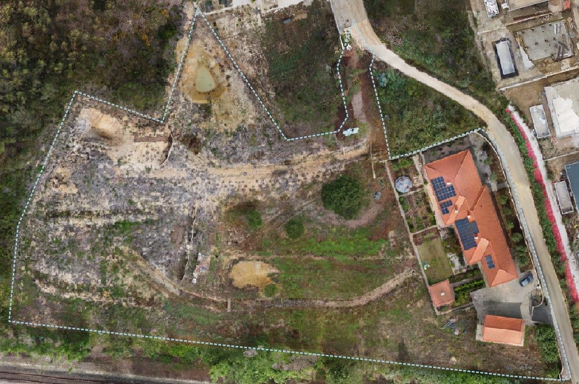
After contacting several companies we picked Agrodrone to do the flight. I think our project was much smaller than the large scale agricultural ones they handle, but despite that they were very responsive, friendly, and professional. Their drone had a very high resolution camera and high precision GNSS receiver, so the resulting orthophoto was excellent. The price was steep: justifiable as an one-off, but would not have been affordable to repeat.
Once we started using the image, we were hooked. We wanted to get updated ones as the project progressed but had to find a way to do so at a much lower cost. We evaluated several ideas:
- Using a drone with high precision GPS, similar to the one used by Agrodrone. A RTK drone would have been very expensive to buy and also require an ongoing expensive subscription for the RTK augmentation data.
- Using a balloon, kite, or pole to lift a camera and pan it around the plot. This seemed very promising and is probably feasible, but initial attempts with an improvised rig were discouraging. I walked around the plot with a 10 meter telescoping fiberglass pole on top of which I had fastened a Xiaomi Yi action camera. The pole was flopping a lot and thus the photos – many of them too blurry – were at all sorts of weird angles, making stitching impossible afterwards. A better way would need a proper camera attachment rig and either a balloon (more popular) or kite (likely better in our windy climate). Either would require a lot of walking around the plot and be more difficult as the trees grow up and there’s more ways to catch and snag the tether line.
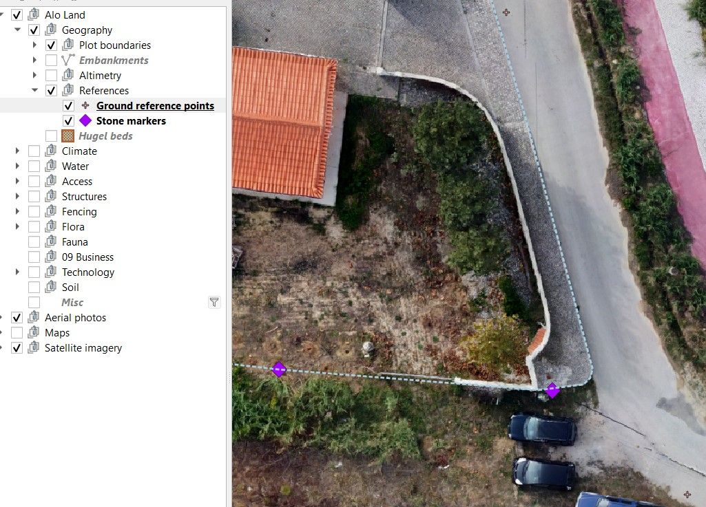
- Using an inexpensive photography drone without high precision positioning. We realized that we had easily visible points whose coordinates and altitudes were exactly measured in the topographic land survey we had done when starting the design work. These points can be used to georeference the orthophoto.
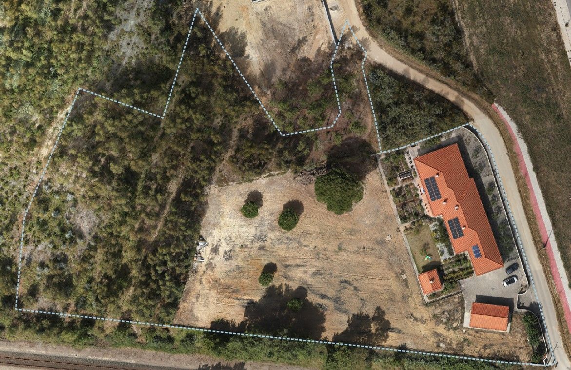
We picked a DJI Mini 2 based on cost, availability, image quality, and size – it weighs less than 250g so there’s fewer restrictions and no registration required to fly it. After figuring out how to take an useful set of images (a bright overcast day is best, to avoid harsh shadows) and stitching them, the result was very promising:
There was still one cost issue: stitching and georeferencing software. There are multiple options available, but the best we found is Agisoft Metashape Professional. It works very well, it has good documentation (helpful if you have no idea what you’re doing), and… is very expensive. We found some alternatives after the 30 day trial ran out:
- Rent Metashape Pro for a few hours through GeoCloud. This works very well and has the added advantage of being quicker due to running on cloud hardware with powerful GPUs (unlike our desktop computer). The cost depends on duration and therefore on the number of images, quality settings, and how much fiddling around you do with the cloud computer running. The first attempts cost close to 50 EUR but it can probably get to around 20 EUR for a typical set of images from our plot.
- Use Maps Made Easy. We haven’t tried this one yet but it looks very promising: easy to use, good quality, and likely cheaper than renting a Metashape cloud instance.
- Use OpenDroneMap. This is completely free and produces reasonable results, although so far for us not as good as Metashape. I’m not sure if this is due to limitations in the software or – more likely – due to me not using the right settings. More learning is needed.
While we’re still refining the workflow, we’re happy with the results so far: aside from the reasonable initial investment, we can now get an aerial image of our garden with very little or no cost within 1-2 days.